Geography, Weather, & Wildlife of Antigua & Barbuda
Geography

Coastline
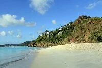
Antigua & Barbuda are two islands in the Caribbean Sea's eastern island chain, known as the Lesser Antilles, and more specifically the Leeward Islands. The country has no land borders, but is very close to St. Kitts & Nevis and Montserrat (a territory of the United Kingdom). To Antigua & Barbuda's east is the Atlantic Ocean.
Antigua & Barbuda consists of three islands. Antigua has some rises in elevation as it's a volcanic island, but none to any true significance. Barbuda is flatter and more vegetated and the final island, Redonda is uninhabited and small. There are no rivers in Antigua & Barbuda.
Weather
Antigua & Barbuda have a relatively consistent weather pattern throughout the year. Temperatures rarely get over 85° F (29° C) and rarely fall below 72° F (22° C). The air is fairly dry year round and the islands receive very little rain. Generally there is a decent breeze over the flat islands, which make temperatures feel a bit cooler. The islands are susceptible to hurricanes (from June to November), although generally when the hurricanes hit they are still in their infancy.