Geography, Weather, & Wildlife of China
Geography

Hong Kong
China, one of the world's largest countries geographically dominates the Far East. This massive country has land borders with numerous countries, including North Korea (northeast), Russia and Mongolia (north), Kazakhstan and Kyrgyzstan (northwest), Tajikistan, Afghanistan, and Pakistan (west), India, Nepal, and Bhutan (southwest), and Myanmar, Laos, and Vietnam (south). Additionally, the island nation of Taiwan is just off of China's southeastern coast. China also borders a number of bodies of water, including the Yellow Sea, East China Sea, and South China Sea.

Tibet
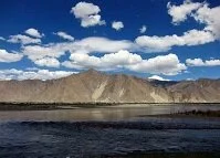
Not surprisingly China, one of the world's largest countries has an incredible amount of geographical diversity. In the country's southwest are the world's tallest mountains, the Himalayas and on the border with Nepal stands the world's tallest mountain, Mt. Everest. Moving north from the Himalaya Mountains the elevation doesn't drop much as the Tibetan Plateau primarily stands at over 12,000 feet (3,500 meters). These mountains also stretch northwest to form China's border with the Central Asian countries. However, moving even further north in the country's western half experiences an elevation decline and fall into the Gobi Desert which borders Mongolia in China's north. From the Tibetan Plateau moving east there are dozens of rivers that cut through the landscapes. The landscapes here vary dramatically, moving from true mountains to hills while containing numerous unique geological features, such as the karst peaks in southern China. In China's far east these rivers flow into the ocean, creating numerous flood plains, deltas, and incredibly fertile lands. Of these rivers, the Yellow River and the Yangtze River are largest, and perhaps the most well-known. Northeastern China, the region known as Manchuria is also fairly hilly and mountainous, but lacks the rivers the south has; this in addition to the climate make this region relatively sparsely populated.