Geography, Weather, & Wildlife of Honduras
WARNING: Violence is common in Honduras, please read this travel warning before going!
Geography

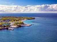
Roatan Island
Honduras sits in the middle of Central America. To the northwest is Guatemala, to the west is El Salvador, and to the southeast is Nicaragua. Honduras also stretches from the Pacific Ocean in the west to the Caribbean Sea in the country's north.
Honduras is a fairly low-lying country in the northwest, but as it moves to the southeast the elevation rises into mountains. There is also a rise in elevation in the country's west so the country is lined with rivers flowing northeast into the Caribbean Sea. Most of the people live along these rivers and in the northwest's lowlands.
Weather

Mountains
Honduras's seasons are wet and dry and these seasons, along with elevation changes, generally are the greatest contributors to the weather alterations. Lands at sea level tend to be very hot and humid during the wet season and can be just as hot and humid during the dry season in many areas. The lowlands tend to get to about 80-90° F (27-32° C) for daily highs. At slightly higher elevation, which is where Tegucigalpa is located, daily highs tend to reach about 75-85° F (24-30° C) year round. The coldest the country gets is in the mountains at night, which rarely hit the freezing point, but can get substantially close. The wet season, or winter, tends to last from about May to September and the dry season, or summer, goes from about November to April. Along the Caribbean coast it rains throughout the year; only the highlands truly have a dry season. There is a chance for hurricanes from about June to November along the Caribbean Sea coast. Although most hurricanes do move north of the country, due to their long coastline it is not uncommon for them to be hit with a hurricane and even when a hurricane misses them directly, the coast tends to receive high winds and rain.